The village the sea took
There was a Middleton here before this one, and most of it is under the sea.
It had a church at Domesday, in 1086. St Nicholas stood south of where Sea Lane now ends, which is to say beyond the present shoreline. The site is under the beach and the water offshore.
How fast it went
The retreat is documented, and the numbers are the part that stays with you.
| 1341 | Erosion already a recorded problem |
| 1606 | The church stands about 170 yards from the high tide mark |
| 1724 | 20 yards |
| 1779 | A groyne is built. It does little |
| 1789 | The sea is within a few feet of the walls. Many graves have already gone, and human bones are being found along the shore |
By the end of the eighteenth century the south aisle had been pulled down and its arcade filled in, and part of the west end including the tower had been removed. Repairs were made in 1803, after which the congregation rarely exceeded six or seven people.
A very high tide in early 1838 finished it. The ruins were still visible in 1847 and had gone by 1849.
A new St Nicholas, of flint and stone, was consecrated in 1849 on a site given by Richard Coote, Lord of the Manor of Middleton. It is the church on Middleton Road.
The poem about your beach
In 1789, with the sea a few feet from the churchyard wall, Charlotte Smith wrote a sonnet about it. It was published that year in Elegiac Sonnets and is still read wherever Romantic poetry is taught.
The wild blast, rising from the western cave, Drives the huge billows from their heaving bed; Tears from their grassy tombs the village dead, And breaks the silent sabbath of the grave! With shells and sea-weed mingled, on the shore, Lo! their bones whiten in the frequent wave
Charlotte Smith, “Sonnet Written in the Church Yard at Middleton in Sussex”, Sonnet XLIV, 1789.
It is not a metaphor. She was describing what was happening a few hundred yards from where the beach huts now stand.
Where it was
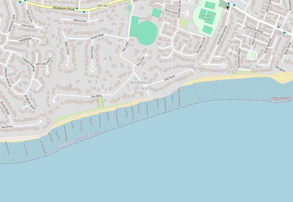
We have not marked a spot, because nobody knows the position closely enough to put a dot on it and a dot would claim a precision that does not exist.
It is not far out, though. Wells from Middleton and from neighbouring Atherington still surface on the beach at low tide after storms, which suggests the church site lies within the intertidal zone or a little beyond, rather than hundreds of metres offshore.
If you would like to compare then and now properly, the National Library of Scotland’s side-by-side viewer puts nineteenth-century Ordnance Survey mapping next to modern aerial photography.
Historic maps, side by side with today National Library of Scotland · centred on Middleton on Sea (opens in a new tab)The village itself
The old settlement did not cluster round the church. It sat inland, where Middleton and Elmer roads meet Yapton Road, and Rose Cottage is one of the few survivors: one storey, flint and thatch, seventeenth century or earlier.
The manor house and the other buildings along the line of Sea Lane were lost to the sea by the middle of the nineteenth century.
It was never a big place. Twelve subsidy payers in 1327. Fourteen adult males in 1642. About thirty-five residents in 1901. The Sea Lane you know dates from 1921 onwards, when Captain Coldicott began building and Middleton became a seaside resort. See the history of the estate.
Middleton was not alone
It is one of a chain of West Sussex settlements the sea took between roughly 1400 and 1850: Atherington, Cudlow, Charlton, the chapel at Kingston and others.